Facing the dual pressures of a growing global population and increasing climate variability, modern agriculture is at a critical juncture. The demand for higher efficiency and sustainability is no longer an option but a necessity. This is where Monitoring Agriculture with Remote Sensing provides a transformative solution, offering a data-driven lens to view and manage agricultural systems. Platforms from Saiwa, powered by advanced AI, turn this complex data into actionable intelligence. This article will explore the core technologies, applications, benefits, and challenges of this revolutionary approach.
How Remote Sensing Supports Agricultural Monitoring
Remote sensing in agriculture is the science of acquiring information about the Earth’s surface—specifically farmland—without being in direct physical contact. This non-destructive method provides a comprehensive overview of crop health, soil conditions, and environmental stressors.
By systematically collecting data over time, it enables the analysis of spatiotemporal variability, revealing patterns of crop growth and stress across both space and the entire growing season. This empowers farmers and agronomists to move beyond intuition and make informed, proactive decisions based on precise, objective data, optimizing resource management from a single plot to an entire region.
Tools and Technologies Used
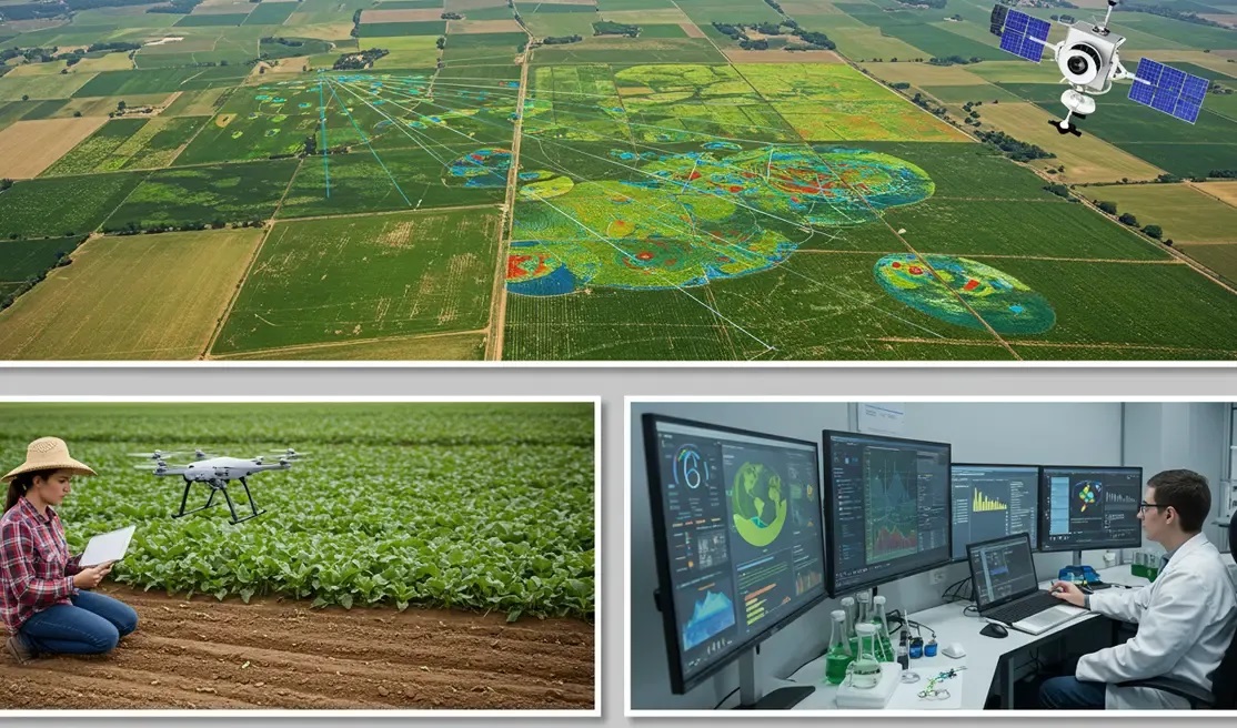
The power of remote sensing lies not in a single piece of technology, but in an integrated ecosystem of tools designed to capture, process, and interpret data from the sky and the ground. This multi-layered approach provides a holistic view of the agricultural landscape. Understanding these components is key to appreciating their collective impact:
1- Satellite Imagery
Satellites provide the macroscopic view essential for regional analysis and large-scale farming operations. Orbiting platforms capture images in various spectral bands, including near-infrared (NIR), which is highly sensitive to vegetation health. Modern constellations offer unprecedented revisit times and spatial resolutions, allowing for consistent monitoring of crop phenology, moisture levels, and broad-scale environmental changes throughout the growing season.
2- Drone & Aerial Imaging
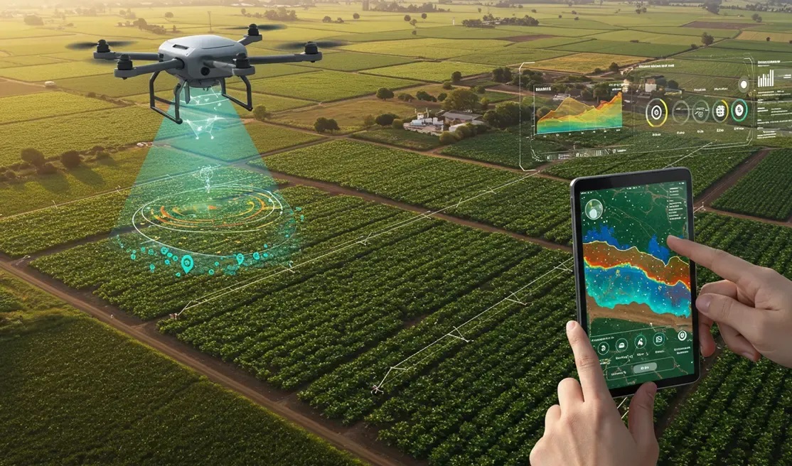
For high-precision tasks, drones and other aerial platforms are unparalleled. They capture ultra-high-resolution images that enable detailed, sub-field level analysis. This granularity is critical for tasks like early weed detection, pest infestation mapping, and assessing plant-level health variations. Services like Sairone leverage this capability, applying sophisticated AI models to drone imagery to automate analysis that would take hundreds of man-hours to complete manually.
3- Field-Based Remote Sensors
Complementing aerial data, in-field sensors—often part of an Internet of Things (IoT) network—provide continuous, ground-truth data. These devices monitor specific variables like soil moisture, temperature, and nutrient levels in real-time. This information is vital for calibrating and validating the data captured by satellites and drones, creating a robust, multi-scale monitoring system.
4- Data Platforms
Raw sensor data, whether from a satellite or a drone, is merely a collection of pixels. Its true value is unlocked through powerful data platforms. These systems use machine learning and AI algorithms to process immense volumes of imagery, transforming it into intuitive maps, charts, and actionable alerts. They integrate data from various sources to provide a unified, clear picture of the farm’s status.
Core Applications of Monitoring Agriculture with Remote Sensing
Once this technological toolkit is deployed and the data is processed, it enables a suite of practical applications that directly address the core challenges of modern farming. These applications transform abstract data points into tangible operational advantages, driving efficiency at every stage of the cultivation cycle. Among the most critical uses are:
- Detecting crop stress and early-stage issues: Analyzing spectral signatures to identify nutrient deficiencies, water stress, or disease outbreaks before they become visible to the naked eye.
- Monitoring soil moisture, salinity, and nutrient status: Assessing subsurface conditions to ensure optimal plant health and resource availability.
- Managing irrigation and fertilizer application zones: Creating precise maps for variable-rate application, delivering water and nutrients only where they are needed.
- Forecasting harvest timing and expected yield: Utilizing growth models fed with remote sensing data for accurate Crop yield estimation, crucial for logistics, market planning, and food security.
Benefits of Connecting Monitoring with Remote Sensing
The adoption of these applications translates into clear, measurable benefits that extend from the individual farmer’s bottom line to global agricultural sustainability. By embedding data intelligence into farm management, remote sensing creates a more resilient and profitable ecosystem. The key advantages are outlined here:
- Faster, more informed decisions: Proactive management based on real-time data rather than reactive fixes.
- Reduced input waste and lower costs: Precision application of water, fertilizer, and pesticides cuts operational expenses and minimizes environmental impact.
- Higher crop productivity: Optimizing growing conditions and addressing stress early leads to healthier plants and better yields.
- Consistency and scalability in large or remote farms: Maintaining a uniform standard of monitoring and management across vast or geographically dispersed operations.
- Improved long-term sustainability: Promoting responsible resource use and building more resilient agricultural systems.
Achieving these benefits requires specialized tools. The Sairone platform, for instance, offers farmers and environmentalists highly focused AI solutions for challenges like weed detection and wildlife tracking. The foundational technologies that power these solutions are also accessible through Fraime, an AI-as-a-Service platform that provides developers with advanced computer vision capabilities like object detection and image analysis for a wide array of industrial applications.
Current Challenges
To present a balanced perspective, it is essential to acknowledge that the path to widespread adoption of remote sensing is not without obstacles. While the technology is powerful, practical implementation faces several hurdles that stakeholders must navigate. The most significant challenges include:
- High startup costs for some technologies: The initial investment in drones, sensors, and subscription-based data platforms can be a barrier for some operators.
- Requires basic digital understanding for interpretation: The data outputs are only valuable if they can be correctly interpreted and translated into effective action on the ground.
- Data limitations under certain weather or terrain conditions: Cloud cover can obstruct satellite imagery, while adverse weather like high wind or rain can ground drone operations.
Conclusion
Remote sensing is revolutionizing agriculture, shifting the paradigm from reaction to data-driven prevention. It optimizes resource use, enhances productivity, and improves decision-making from field to fork. While challenges exist, the fusion of advanced sensors with intelligent platforms is crucial for building a sustainable, efficient, and secure global food system. This technology is no longer an option but a cornerstone of modern farming.

